The Setup
A low pressure area in southwestern Oklahoma, along with a warm front to its east, and a dryline extending southward through far western North Texas, offered various areas of focus for supercell development and tornadoes today. HRRR runs showed the best supercells were along the warm front in southern Oklahoma. We set these forecast storms as our target for the day. We were hoping to chase these west of I-35 in Oklahoma because the chase territory east of I-35 is pretty unfavorable.
The Chase
This was the first day or Tempest 2026 Tour 2A, which was a photography tour. These folks had some pretty nice cameras along and were wanting to get some good structure photos and lightning shots. The weather during most of this tour was not great for that.
After an orientation, delayed until 11:00 AM because the target was so close to Oklahoma City, we began the drive southward to get in place prior to storm initiation. We ended up waiting in Elmore City for at least a couple hours as cells percolated around us.
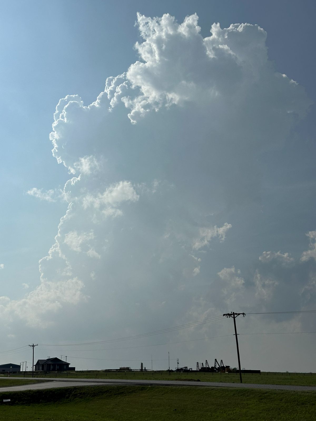
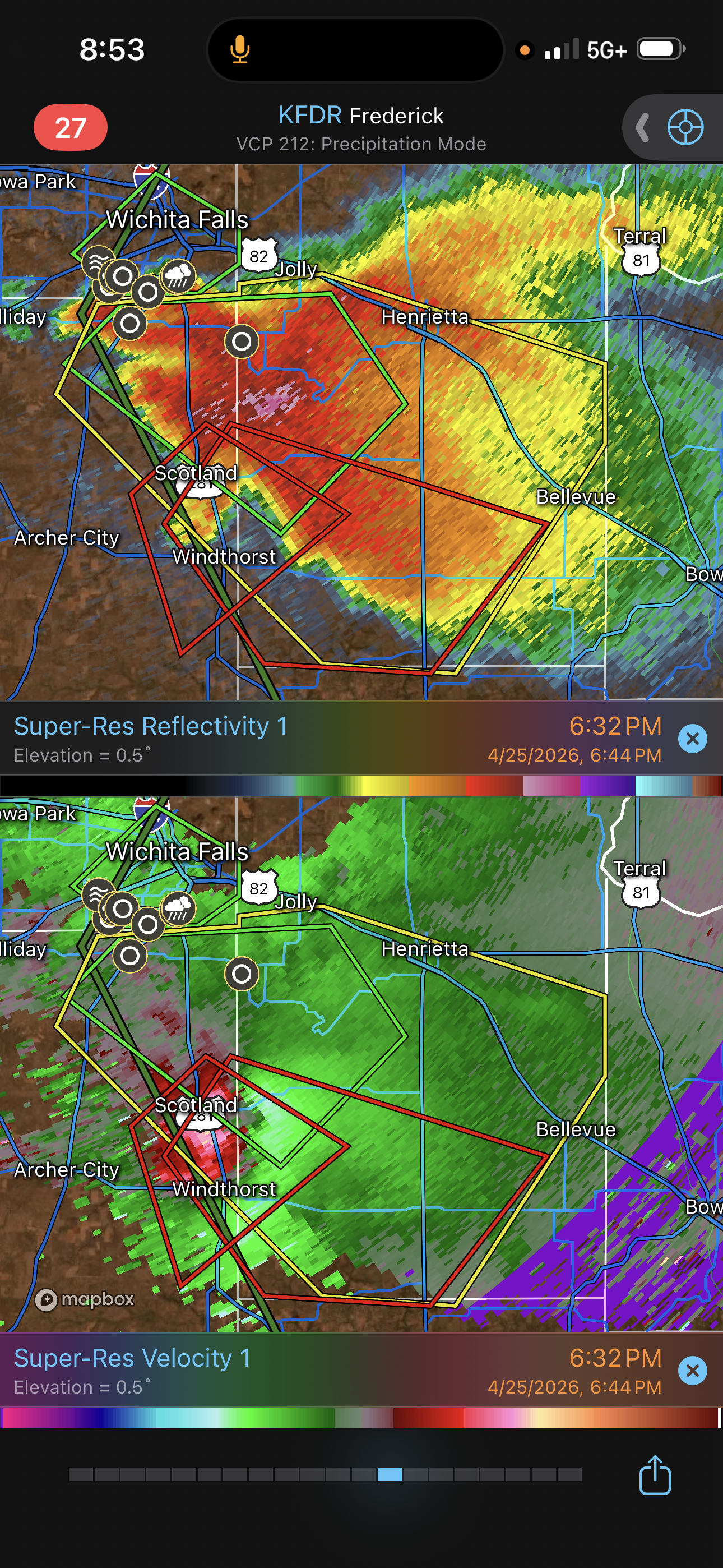
The first cell went up just to our north and drifted east, but it wasn't initially very strong, and it was drifting east into the trees, anyway. We let this one go and watched more towers develop to our west and northwest. The strongest storm developed near Wichita Falls, which was out of our target area. I thought the bases on this storm would be a bit higher and less favorable for tornadoes, but dewpoint was near 70 degrees, and CAPE and tornado-related parameters really weren't any worse in this area than they were in southern Oklahoma. We did not go after this cell.

The Wichita cell did two things that made our day a bit less fruitfull. First, the storm split, and the left split went north and crashed into the storm that we initially intercepted, causing our storm to weaken. This started our search for storms farther east. The second thing the Wichita Falls storm did was produce tornadoes. It ended up being the storm of the day. We could have gotten to it had we left Elmore City as soon as that cell developed we probably would have seen tornadoes with that southern storm, but we decided to be patient.
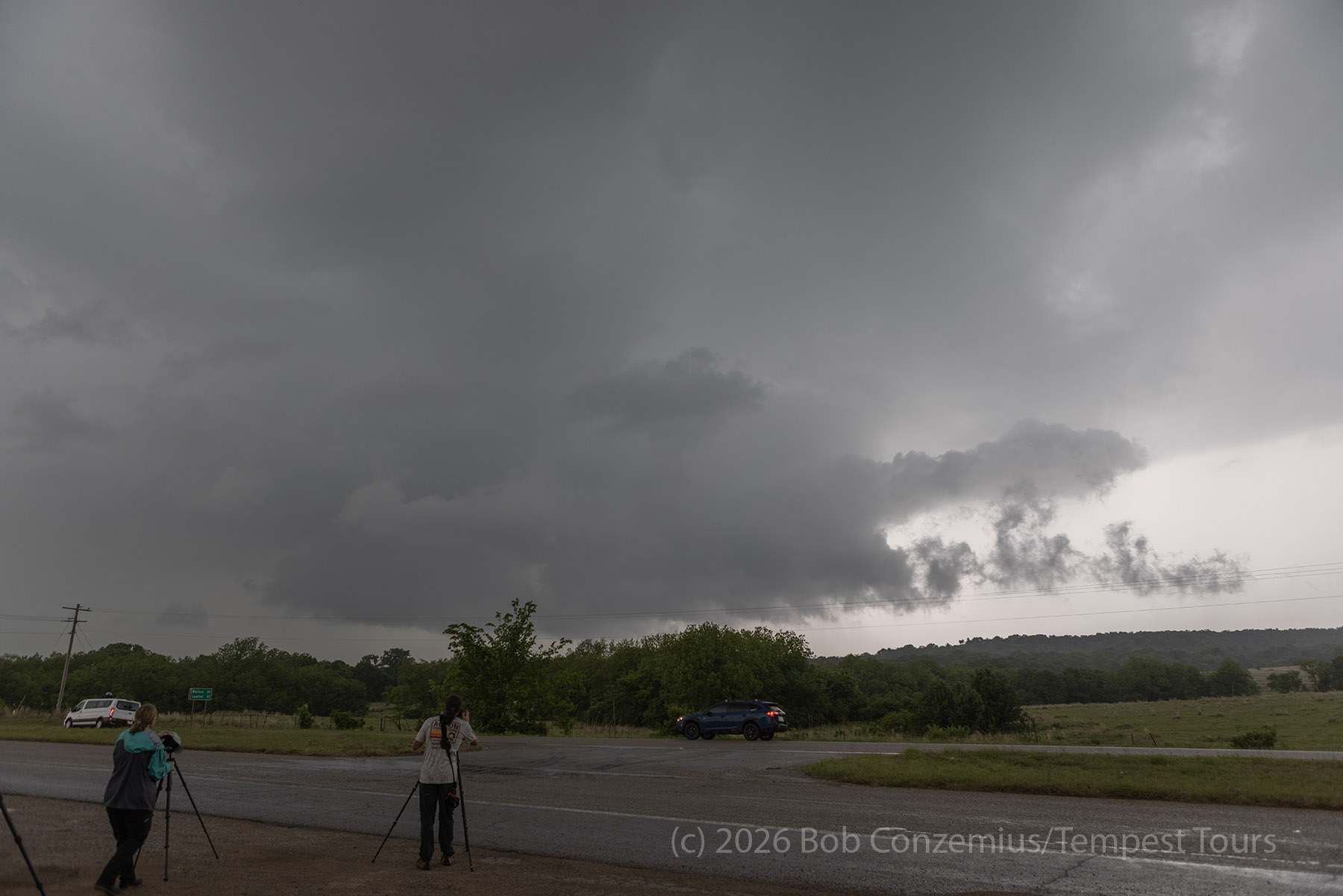
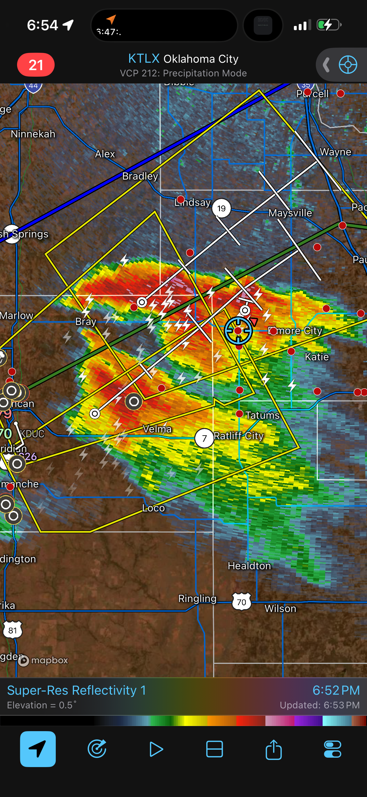
After the left split collision ruined our cell, we moved east, and we found a new storm near Sulphur, Oklahoma, just east of I-35. This storm had some decent rotation on radar, and a tornado warning was issued for it, but we could not verify any rotation or see any funnels or tornadoes with the storm. We quickly let this one go since sunset was approaching, and storms were restrengthening back to the west.
We found a storm west of Hennepin, Oklahoma. It was now after sunset, so we tried some lightning photography on it for a bit. I kept my eye open for any rotation and found a couple areas that were interesting for a bit, but I didn't really take any photos. Around 8:45, we gave up and began our way back to our hotel for the night in Purcell.
Wrap-up
A bit of frustration with finding a good storm we could stick with. I'm glad Martin (owner of Tempest Tours) got on that Wichita Falls/Scotland cell and was about to document at least one tornado with it.