The Night
A major CME impact during the day had brought some exceptionally large magnetic field values in the solar wind with Bt reaching 90 nT and Bz dropping briefly to -50 nT. With these values, there was at least some possiblity that we would have a very major geomagnetic storm. As it was, we had a Kp8 storm during the late afternoon local time. However, the magnetic field switched north, and in the evening, values were near +50 nT. Solar wind speed, however, was 1000 km/s, and this would cause major disturbance even without a southward Bz. These fast wind speeds would quickly bring us into the core of the CME, and the magnetic field could slowly change direction.
Sure enough, the Bz values started to trend toward zero and then became negative close to midnight. Meanwhile, Bt dropped to near 30 nT. I decided to head out and check for auroras. If the trends continued, I would be seeing some strong auroras. Bz was trending south, the moon phase was new, and clouds were minimal.
Right to my Favorite Spot
I didn't really stop anywhere to check to make sure the drive was worthwhile. I simply went to my favorite spot about 30 minutes from home. When I got out of the car, I was expecting a glowing horizon, but I couldn't see much. I thought the auroras hadn't had much of a chance to come out yet, so I walked out from the boat landing onto the lake. When I got past the point, where there was a better view of the northern horizon, I saw the clouds. This surprised me. These clouds were low, thin, and nearly invisible on infrared satellite pictures, but they were certainly visible with the eye.
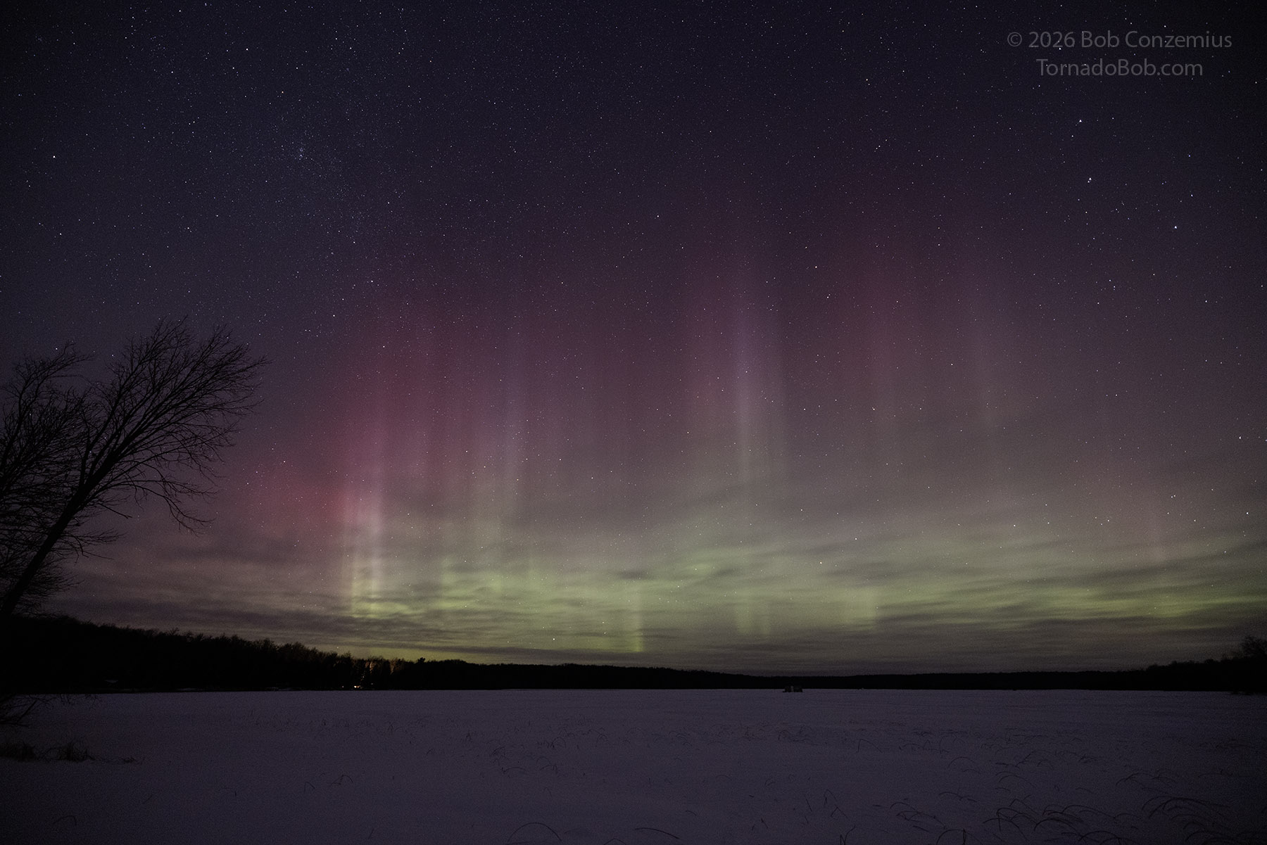
I decided to be patient, and if the auroras became significant enough, they would shine through the clouds. As good luck would have it, the auroras brightened, and the clouds moved out. A substorm started before it had cleared completely. This substorm was pretty mellow, slowly evolving from a brightening band on the horizon and featuring tall, dim, reddish columns. That spread over the northern half of the sky. I let the camera do its timelapse and monitored Bz on my phone.
The substorm went into the recovery phase, bringing diminishing auroras, while Bz continued to drop. I figured another substorm would commence in an hour or two.
A Second Substorm
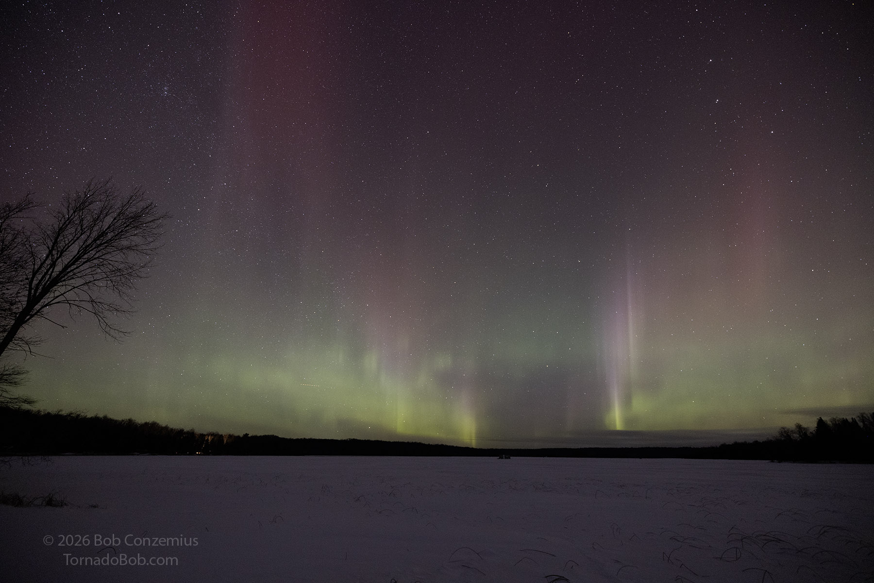
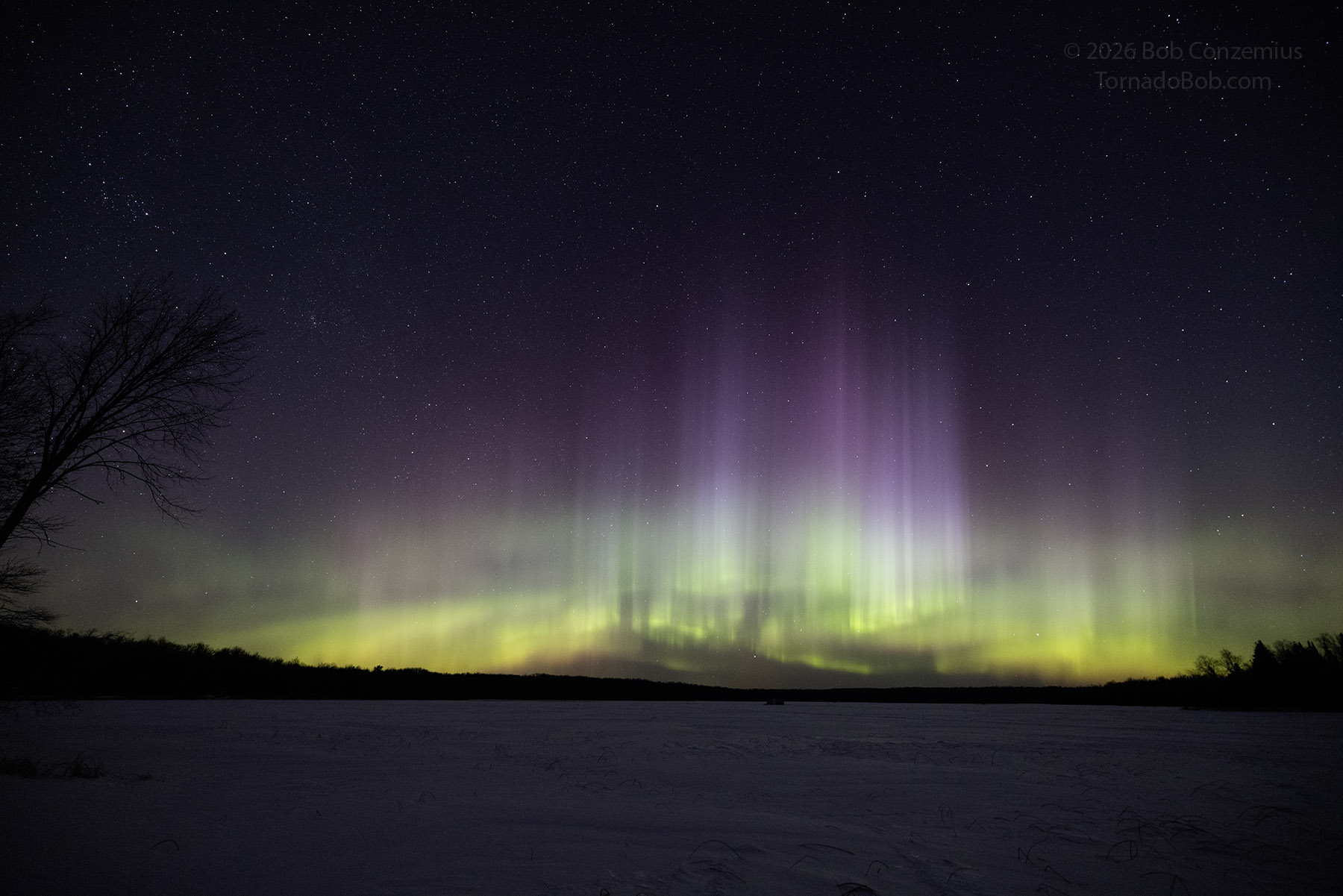
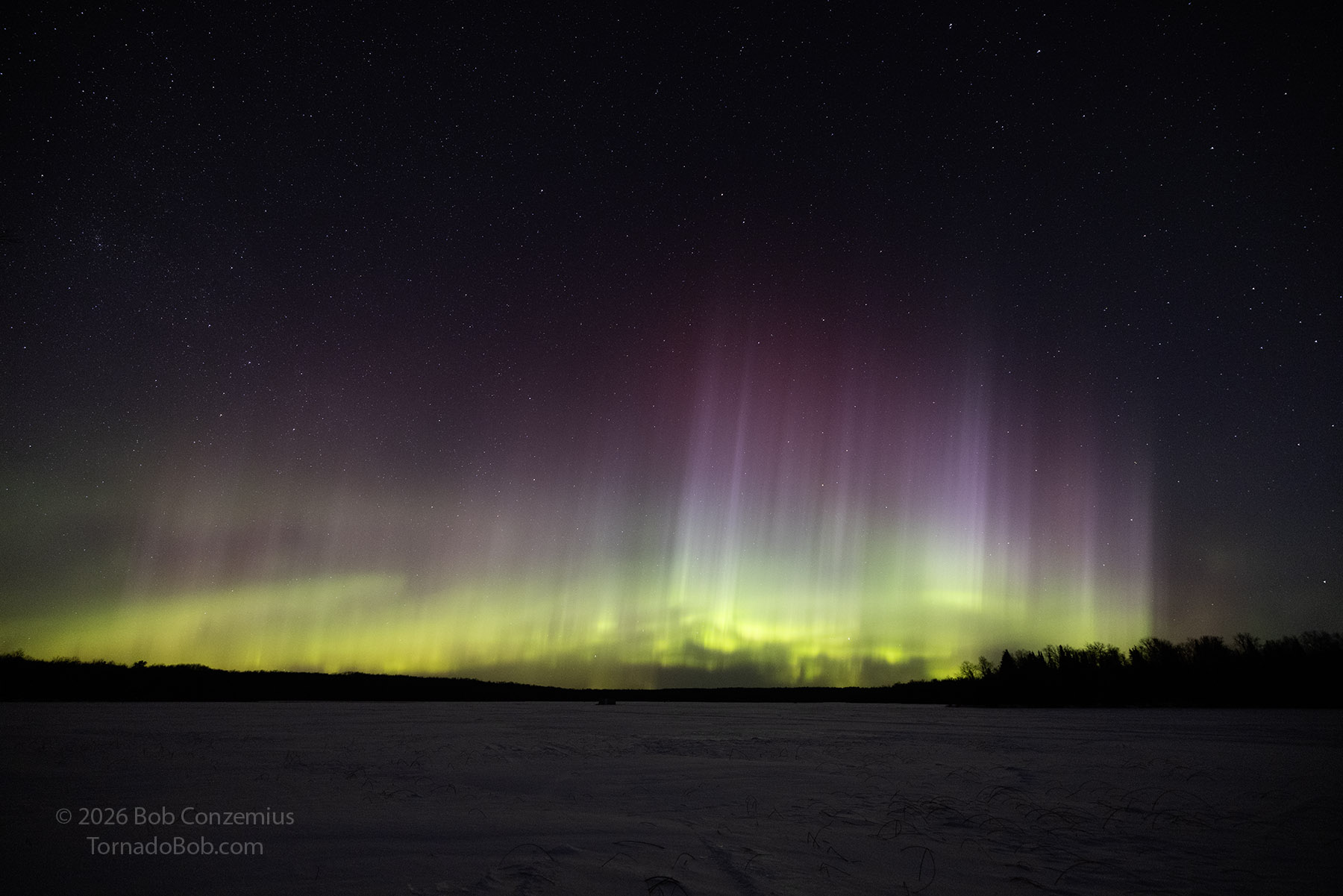
Evenually, the auroral arc retreated and reformed on the northern horizon. The colors brighened, and a second substorm occurred. This one featured brighter auroras and more colors.
Wrap-up
Reflect on the night — how it compared to past displays, any gear notes, or what you'd do differently next time.